
Reviewed · HIKING & TREKKING
Discovery hike along the Trondheimsfjord
Trondheim’s fjord trails have a way of surprising you. This one blends Trondheimsfjord views with World War II remains on the Lade peninsula, told clearly by guide Gaël. I love how the walk feels calm and local, and how each photo stop comes with practical context about Trondheim’s coast. One thing to plan for, though, is that it is a one-way route, so you need the return bus (and good shoes) to make the timing smooth.
I also like the “move-and-learn” pacing. You’re out for 2.5 hours and about 6 km, with frequent chances to pause for viewpoints and coastal details. The only real drawback is weather, because it is outdoors most of the time and Norwegian conditions can change fast.
Logistics are doable from the city. You meet at the Korsvika parking lot, then head back toward town from Rotvoll using bus 2 and bus 20, with help from the official ATB app for exact timetables.
In This Review
- Key highlights worth getting excited about
- Why Ladestien feels like local Trondheim, not just sightseeing
- Korsvika to Rotvoll: the one-way 6 km route and how to time it
- Stop-by-stop: what each part of the walk is really for
- 1) Korsvika photo stop, the fjord comes first
- 2) Østmarka German bunker stop, WWII history you can see
- 3) Ladekaia photo stop, the coast with a working feel
- 4) Sponhuset photo stop, details that reward slow looking
- 5) Devlebukta photo stop, beach atmosphere before you finish
- 6) Finish at Rotvoll, smooth return to the city
- Nature notes: flora, fauna, and what to watch for on this kind of coast
- Price and value: what $72 buys you here
- Difficulty level: what medium really means for your day
- Who this hike suits best, and who should reconsider
- Should you book the Discovery Hike on the Trondheimsfjord?
- FAQ
- How long is the discovery hike along the Trondheimsfjord?
- When is the tour available?
- Where do I meet the guide and where do I end the hike?
- How do I get to the start from Trondheim city center by public transport?
- What language is the guide, and what is included in the price?
- Is the hike wheelchair accessible, and what should I wear?
Key highlights worth getting excited about
- Photo stops that explain what you are actually seeing, not just pretty spots
- World War II remains on the Lade peninsula, including an Østmarka German bunker viewpoint
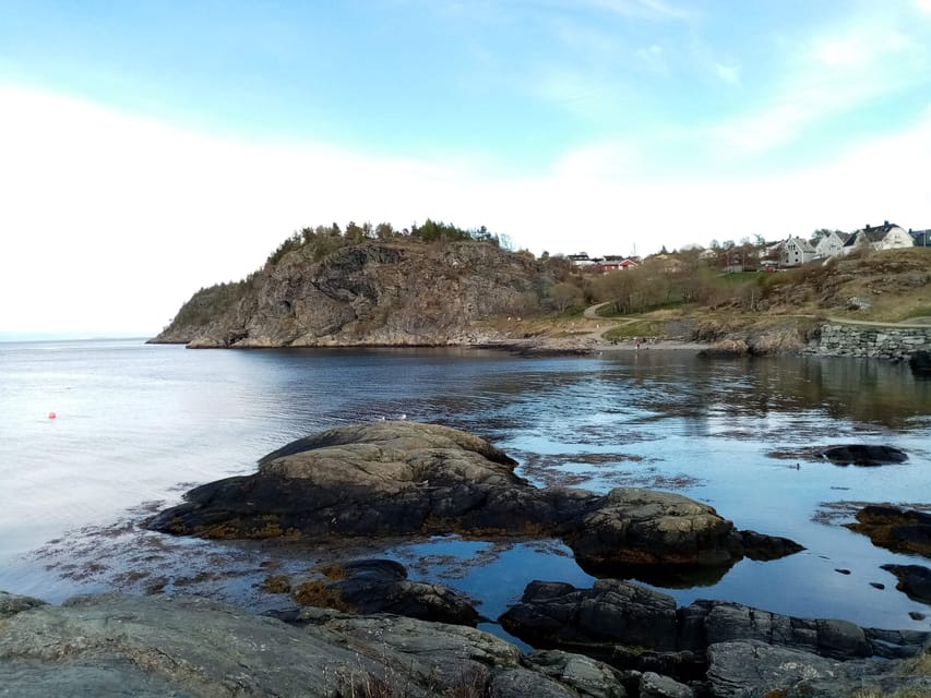
- Fjord views plus a beach setting, so the walk never feels repetitive
- A relaxed group pace that works well for people who want a pleasant hike
- A guide who connects nature and Trondheim history, including flora and fauna notes
Why Ladestien feels like local Trondheim, not just sightseeing
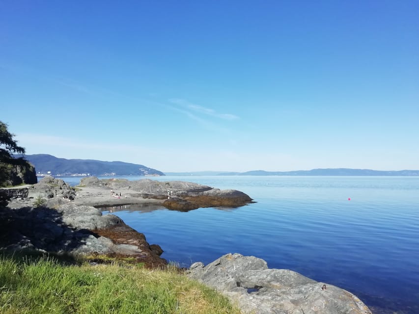
The Ladestien hike along the Trondheimsfjord hits a sweet spot. It is not a “race to the viewpoint” kind of outing. Instead, you walk at a comfortable rhythm while the fjord does what it does best, big water, changing light, and coastlines that look different from every angle.
What makes it feel local is the mix of everyday scenery and history you can still touch. You get beach atmosphere and fjord air, but you also see the Lade peninsula as a place that mattered during World War II, not just a postcard. If you like Norway where the scenery and the stories sit side by side, this tour fits that mood.
Also, the guide style matters. With Gaël & Maëlle Travel operating in French and English, the explanations land well, and the pauses for photos feel purposeful. The result is a walk where you understand why a spot matters, not just where it is.
Korsvika to Rotvoll: the one-way 6 km route and how to time it
This is a one-way hike, around 6 km total, lasting about 2.5 hours. You start at Korsvika and finish in Rotvoll, so you are not doing the easy trick of circling back to where you began. The good news is that the route is planned to match the return options in Trondheim.
You meet at the Korsvika parking lot, less than five minutes from the bus stop named Ingemann Torps vei. The guide holds a sign for Gaël & Maëlle Travel, which is a helpful detail if you arrive and do not want to guess where the group will gather.
From the city center, you take bus 2 toward Strindheim, getting off at Ingemann Torps vei. The bus runs about every 10 minutes, which makes the start feel flexible even if you are building the hike around other plans. At the end, you take bus 20 from Rotvoll toward Romolslia, with buses roughly every 15 to 30 minutes, and the stop is about a 10-minute walk from the finish point.
If you like structure, book your timing so you are not sprinting between bus stops. Aim to arrive a bit early at Korsvika, especially if you want an easy, unhurried start and time for a bathroom stop before you begin.
More summits earned on foot:



Stop-by-stop: what each part of the walk is really for
The hike is built around a chain of photo-worthy stops, each with explanations. That means you are not just following a path, you are collecting viewpoints, coastal details, and historical context in a logical flow.
1) Korsvika photo stop, the fjord comes first
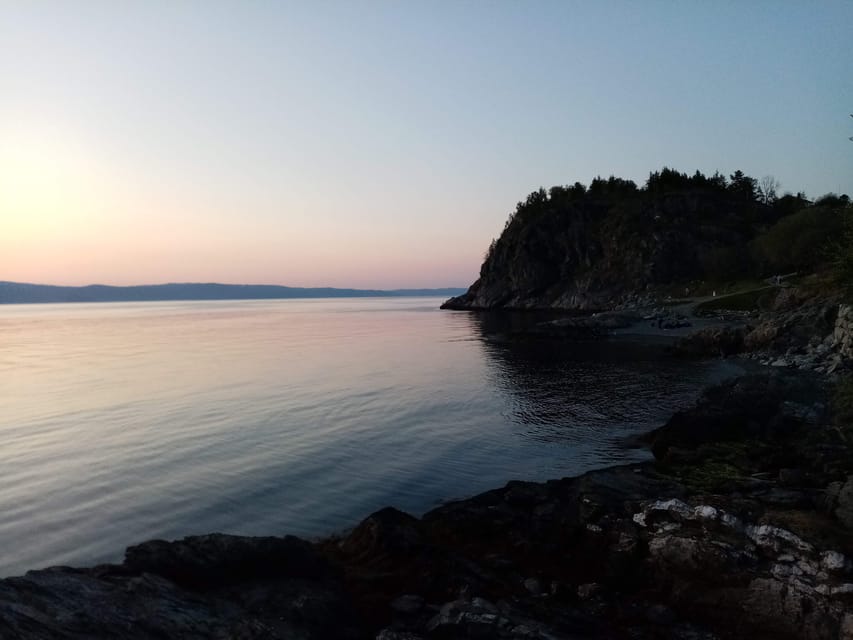
Korsvika sets the tone. You start with a photo stop right away, and it is a smart move, because it helps you get your bearings while the fjord is in full view. From the beginning, you are learning how this coastline connects to Trondheim’s broader story.
For you, this opening stop matters because it anchors the trip. Once you understand what the area looks like from the start, the later WWII remains and coastal structures will feel more meaningful, not random.
2) Østmarka German bunker stop, WWII history you can see
One of the standout points is the Østmarka area and its German bunker remains. It is not just a grim “look and move on” moment. The guide’s explanations give you context for what you are seeing, so the ruin becomes a readable part of the landscape, not a vague relic.
This stop is likely to be the one you remember later, because it adds real human scale to the history. You are outside, near the fjord, and you can sense why coastlines and vantage points mattered during the war.
Practical consideration: if you are sensitive to exposed outdoor conditions, dress for wind and cold here too, because you will likely want time for photos.
Where the path branches next in Trondheim
- Trondheim: Private Walking Tour with a Local
★ 4.5 · 110 reviews - Trondheim: City Highlights Bus and Walking Tour
★ 4.4 · 96 reviews - Trondheim : Explore the city of kings with a local guide
★ 4.8 · 70 reviews - Trondheim: Discover the city of kings with a local guide
★ 5.0 · 41 reviews
3) Ladekaia photo stop, the coast with a working feel
Ladekaia shifts the mood back toward the shoreline. This is where “fjord and daily life” starts to feel real. You are seeing how this part of Trondheim sits with water nearby, where the coast shapes the way people live and move.
This stop also keeps the energy up. After the WWII stop, it is a relief to step into something lighter, still coastal and scenic, while the guide continues linking the stories to place.
4) Sponhuset photo stop, details that reward slow looking
At Sponhuset, you get another pause for photos and explanation. Stops like this are where the tour earns its value. Instead of a long stretch of walking with no reason to stop, you get small “missions” to notice specific features.
If you like travel that teaches you how to look, this is your part. You’ll likely find yourself watching for coastal clues, plant patterns, and how the terrain transitions between sea-facing and inland edges.
5) Devlebukta photo stop, beach atmosphere before you finish
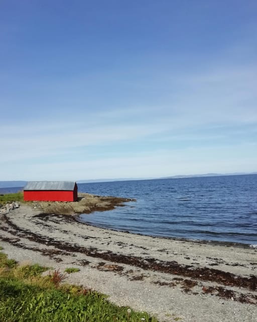
Devlebukta brings you toward the end with a beach feel. This is a good “cool down” moment before the finish, because it shifts you from history and structures back to the atmosphere of water and shoreline.
For many people, the last viewpoint is the one that clicks hardest, because you have the full walk’s context in your head now. The earlier stops help you recognize what you are seeing, so the final beach setting lands better.
6) Finish at Rotvoll, smooth return to the city
You end in Rotvoll, and then you transition to the bus back toward the city center. The route being one-way is not a dealbreaker because the return is straightforward, but it does mean you should respect the timing. Walk smart, then take the bus when you are ready.
Nature notes: flora, fauna, and what to watch for on this kind of coast
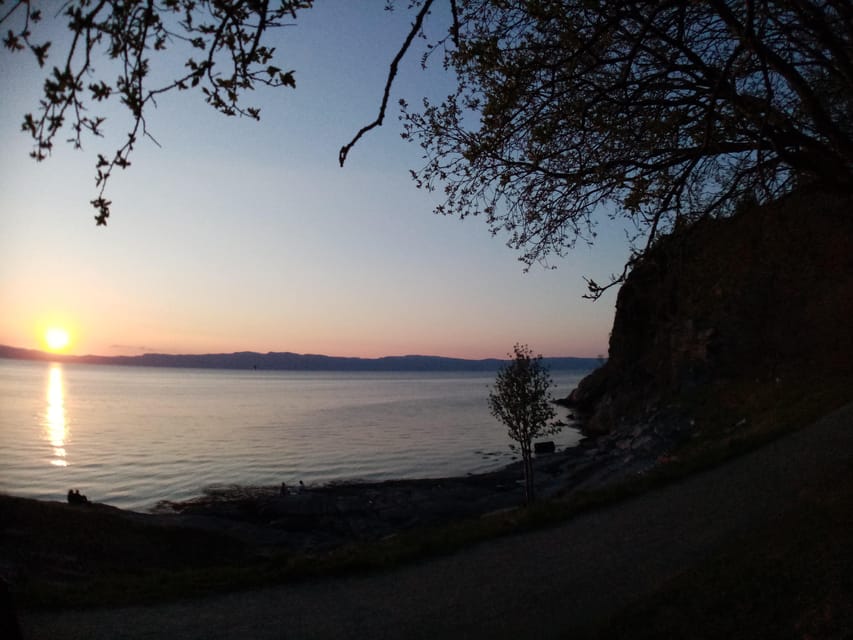
This tour is not only about ruins. You also get learning about flora and fauna of the Lade peninsula. Even if you are not a “nature facts” person, the guide’s habit is to point out what is visible right then, not facts dumped from a book.
That matters because coastal ecology changes with light, wind, and season. You will be outdoors from March to October, and conditions can shift quickly, which is why the guide’s real-time observations help. You might find yourself noticing how plants handle exposure, how wildlife behaves around the shoreline, or how the terrain shapes what grows where.
The practical tip here is simple: keep your eyes up and your camera ready, but also look down. Coastal walks often hide the best clues at ankle height, where you finally slow down enough to see the details.
Price and value: what $72 buys you here
At $72 per person for about 2.5 hours, you are paying for more than walking. You are buying a guided route that connects three things you might otherwise piece together on your own: the fjord scenery, the WWII remains, and the nature-and-history context that makes those stops click.
What is included is clear: a local guide and the hiking tour. What is not included is food and drinks, so plan to bring water if you like to sip during breaks. You do not want to arrive hungry after a medium hike, especially if you will be finishing in Rotvoll and heading back into the city.
The value logic for this tour is strongest if you want interpretation. If you are the type who can happily read signs and spot details alone, you might think you could do it independently. But if you want the stories tied directly to what you see on the route, a guided format helps a lot.
And one more quiet value point: the transport planning is part of the deal. You get a workable start and end pairing, plus specific bus guidance to avoid stress.
Difficulty level: what medium really means for your day
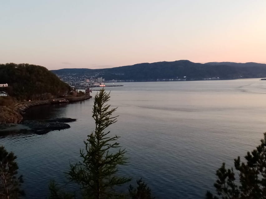
The tour is listed as medium difficulty. With a distance around 6 km, it should fit many active travelers, especially those who can handle an outdoor walk on uneven ground and varying weather.
Still, you are in Norway in a fjord area, so conditions can change. Strong wind, wet patches, or cold damp can turn a normal walk into a tougher one. This is why the basic gear advice is not optional: bring comfortable shoes and comfortable clothes, and dress for wind and sudden shifts.
One more thing: since it is one-way and you are not looping back, you should pace yourself for the full route instead of banking energy for a last-minute sprint.
Who this hike suits best, and who should reconsider
This is a great fit if you want:
- fjord views with history, not history as a side note
- a calm group pace and planned photo stops
- a guide who explains the coast, ruins, and the local plant and animal world
- an easy way to connect Trondheim’s outer areas to your day without renting a car
It is less of a fit if:
- you need wheelchair access (this hike is not suitable for wheelchair users)
- you dislike one-way routes that require bus planning
- you are very weather-sensitive and do not want to be outside in changing conditions
If you are traveling in a small window of time, a 2.5-hour hike is also handy. It is long enough to feel like an outing, short enough to still leave room for Trondheim sightseeing after.
Should you book the Discovery Hike on the Trondheimsfjord?
I think you should book it if you want a fjord walk with real context, not just views. The combination of photo stops, WWII remains like the Østmarka German bunker area, and guidance about flora and fauna makes it feel like a guided story you can walk through.
Book it especially if you like learning without turning the day into a classroom. The format is active, outdoors, and easy to follow, and the finish in Rotvoll keeps your return simple with bus 20.
If you are uncomfortable with one-way routes or unpredictable weather, pause and plan your clothing and timing carefully. For me, the decision comes down to this: do you want to understand what you are seeing along the Lade peninsula? If yes, this tour is a strong match.
FAQ
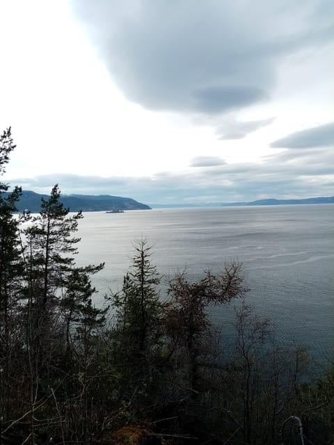
How long is the discovery hike along the Trondheimsfjord?
The hike lasts about 2.5 hours and covers around 6 km.
When is the tour available?
It runs from March to October.
Where do I meet the guide and where do I end the hike?
You meet at the Korsvika parking lot. The hike finishes in Rotvoll.
How do I get to the start from Trondheim city center by public transport?
Take bus number 2 toward Strindheim and get off at Ingemann Torps vei. The meeting point is about five minutes from that bus stop.
What language is the guide, and what is included in the price?
The live guide speaks French and English. The price includes the local guide and the hiking tour.
Is the hike wheelchair accessible, and what should I wear?
This tour is not suitable for wheelchair users. Wear comfortable shoes and comfortable clothes, and dress for unpredictable Norwegian weather since it is outdoors.
Newly marked on the map for Trondheim
- Snowshoeing Adventure in Estenstadmarka★ 5.0 · 1 review
- Trondheim to Trondheim Airport (TRD) Departure Private Transfer★ 5.0 · 1 review
- Trondheim Private Walking Tour★ 5.0 · 1 review
- Nordic Signature Snowshoeing in Trondheim & Tram Journey★ 5.0 · 1 review
- Discover the unmissables places of Trondheim★ 4.5 · 6 reviews
- 2 Hour City Walk through Trondheim★ 4.5 · 8 reviews
- Trondheim’s Regalia Self-Guided Tour of Norway’s Historic Centre★ 5.0 · 9 reviews
- City Bus Tour in Trondheim, Norway★ 3.5 · 13 reviews
Hiking & Trekking, compared.


Guided Husky Snowshoe Hike and Husky Camp Visit
Read our review →

Preikestolen (Pulpit Rock) Hike with Local Guide
Read our review →
Browse the lists this tour appears in